Bears Crossing

Hiking & Biking

Bear Crossing Community

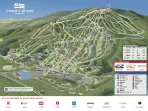
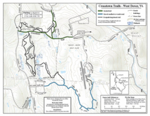
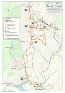
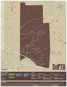
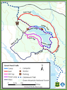
While the main winter activity at Mount Snow is obviously skiing and snowboarding, there are other outdoor activities in the nearby area that you can enjoy, particularly hiking year-round and snowshoeing.

This map is the best overview of trails within West Dover and Wilmington. You may not realize how many local trail systems there are just within West Dover. In fact, there’s a chance you didn’t know there is a marked set of trails just behind Bears Crossing on the south border.

Map of Yellow, Red and White Trails behind Bears Crossing

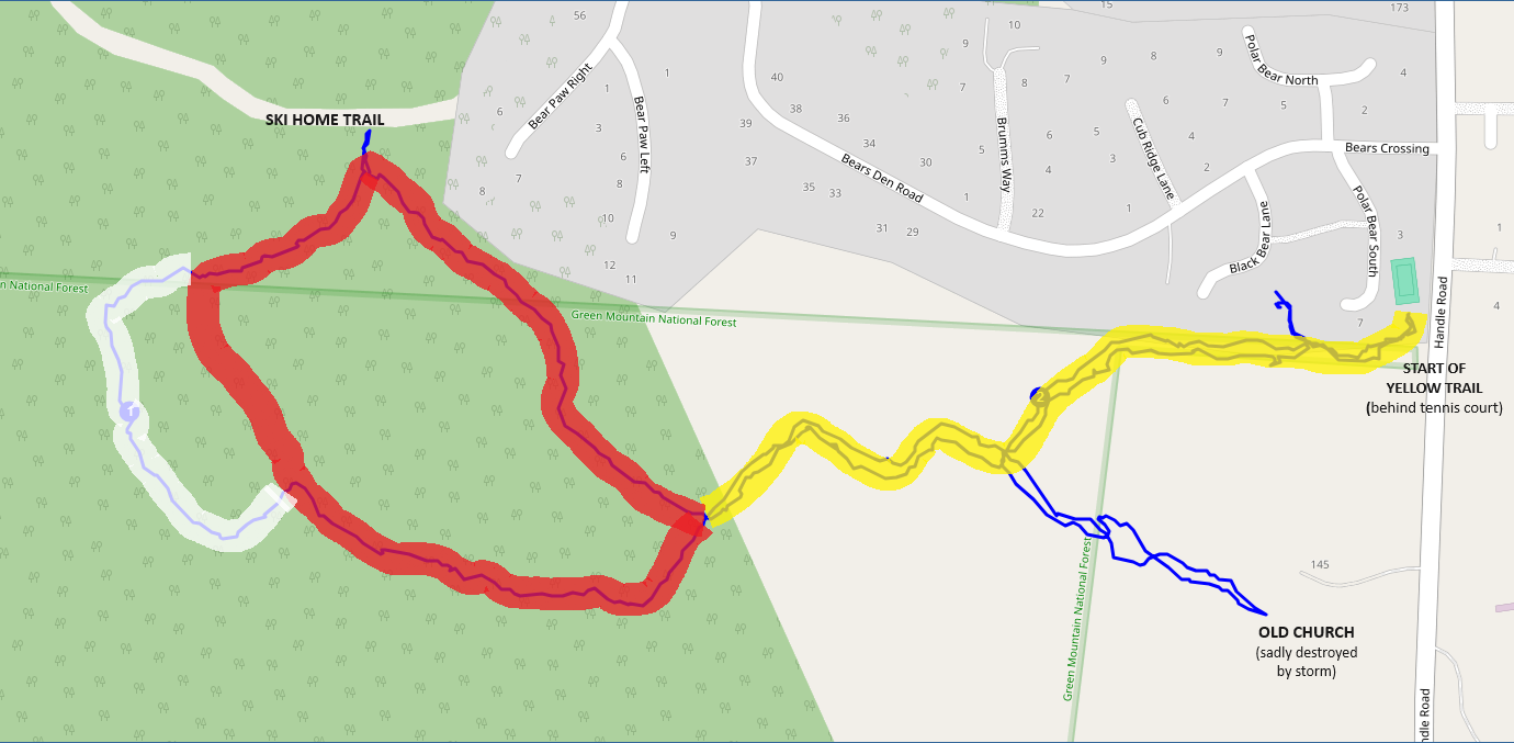
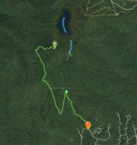
This system of trails was created and blazed many years ago by a Bears Crossing resident (you can find his initials carved into the bridges he built), and you can follow them starting at the Yellow Trail just behind the tennis court. It goes through a stretch of the Green Mountain National Forest along our border, which connects to the Red loop trail which connects to the ski home trail. And there’s a small White semi-circle trail as well. It’s around 1.75 miles in total, but you can add on a small extra spur which takes you to the ruins of an abandoned church that’s right out of the Blair Witch Project. For a longer hike you can also continue up the ski-home trail to Fools Gold Ski Trail. During ski season you’ll need to be watchful of skiers coming down so stick to the sides.

For more hiking opportunities in Southern Vermont, check out:  https://vtliving.com/hiking/southernvermont/

Nearby Trails:

There are blazed biking and hiking trails all the way to the summit of Mount Snow (3586′) from the base. You can also connect to these trails by heading up our own Ski Home Trail.

A little further away, there’s a larger set of well-maintained trails around Crosstown Road starting on Handle Road just a half-mile south of us. There’s a parking lot at the trailhead, which is no longer a road
but a well-graded and easy 1-mile long trail that ends by the Mount Snow Golf Course. There are a number of side trails coming off this, all with Robin Hood-themed names. They are used year-round for hiking, trail running, mountain biking and even cross-country skiing. They are well marked and maintained. A full map at the trailhead will show you all the options.

Some of these trails are also part of the larger Valley Trail, which technically goes from Mount Snow all the way to Route 9 in Wilmington. But it’s best to start from Crosstown Road. There are some sections where you walk along roads, but the majority of it is a well-maintained path through the woods.

If you’ve ever parked at Dot’s or the movie theater, then you’ve been to the start of one-mile bike path that parallels Rt. 100 going south. If you go down about ⅓ of a mile, you’ll come to a trailhead for Horace Hill. This is a section of forest that has been blazed for backcountry skiing, as you will see green and blue markings. But it’s also available to hike, snowshoe and cross-country ski through as well. There is a map at the start and at certain intersections to help you along.

Similar to Horace Hill, there’s a larger section of land a little further away known as Dover Town Forest. You’ll drive up through some windy roads and beautiful views to get to the parking lot where multiple trailheads are. There are a few different trails for hiking and snowshoeing, as well as sections for backcountry skiing.

The most popular summit to hike in the area is Haystack Mountain. It’s a 4.2 mile out-and-back and you’ll gain a little over 1000 feet of elevation to get to the summit (3445′). The trailhead is in the Chimney Hill development in Wilmington and is a little tricky to find. But it’s worth it. There is a ridge trail that continues from Haystack all the way to Mount Snow. Please note it hasn’t been maintained for years but there are plans to restore it.

If you’ve ever been to the top of Hogback Mountain to see the 100 mile views or enjoy Beer Naked Brewery and Metcalfe Distillers, you’ve been near a few different trail systems on both sides of the road, some of which go down former ski slopes. There is parking on the south side of the road and a parking lot on the other side. There are trailheads with maps available. From the fire tower at the top, you can head down a trail to Molly Stark State Park.

A really beautiful area to hike just north of Bears Crossing is Grout Pond. It’s about 12.5 miles away toward the direction of Stratton. Year-round this is a gorgeous place to hike, snowshoe or cross-country ski. There are a few different, relatively easy trails that go around the pond. In winter you have to park a little further away. But if you’re a X-C skier, these trails connect to the Catamount Trail, which is a X-C trail the length of Vermont.